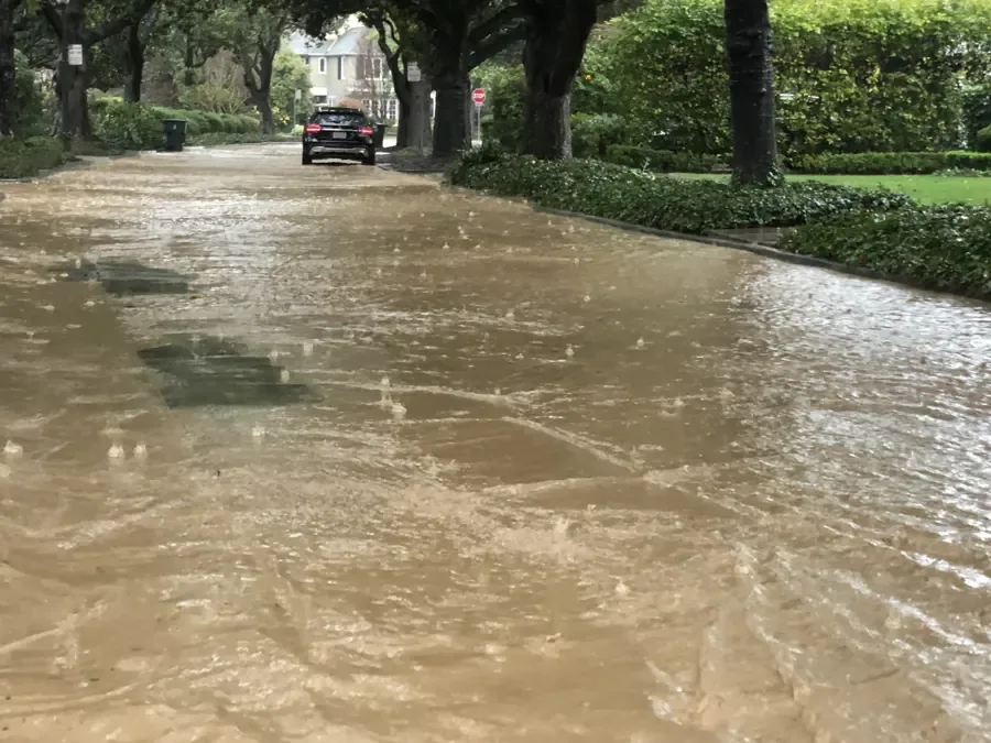
When the Cooper River rises, the National Weather Service gauge at Haddonfield gives a running picture of what is happening to parks, paths and streets. The gauge notes name real places, which makes them a useful early signal for anyone who lives or works nearby. This post explains what each level means, what the notes leave out and what the cleanup looks like if flood water ever reaches a building.
Key takeaways
- The Cooper River gauge at Haddonfield marks overflow into Maria Barnaby Greenwald Park at 2.5 feet and flooded paths at 4.5 feet.
- At 5.5 feet Grove Street and Coles Mill Road begin to take on water, and at 7 feet Coles Mill Drive is impassable.
- The gauge notes describe parks, paths and roads. They are an early warning, not a count of what happens inside any house.
- Creek and street water that gets into a building is handled as contaminated flood water, not as a clean spill.
- The early July 2023 storm flooded streets here, a reminder that fast rain matters even when the river is not the cause.
The Cooper River and the borough's small water features
Surface water in the borough is limited. The borough stormwater element names only the Cooper River, Hopkins Pond and Evans Pond, and the Cooper River forms the border with Cherry Hill.
Evans Pond sits above Wallworth Lake in Wallworth Park, with a dam between them, and the early headwaters of the Cooper River flow into Evans Pond. The borough's stormwater system also outfalls into the Cooper River, so street runoff and river flow meet in the same place.
- Hopkins Pond covers about 33 acres and was created in 1789 when a small tributary of the river was dammed to power a gristmill.
- Hopkins Lane is built on top of the earthen dam that holds the pond back.
- Evans Pond and Wallworth Lake sit one above the other in Wallworth Park.
Reading the gauge, level by level
The National Weather Service attaches plain notes to specific readings on the Cooper River gauge at Haddonfield. Each one says what happens next on the ground.
- At 2.5 feet, water begins to overflow the banks into Maria Barnaby Greenwald Park.
- At 4.5 feet, park flooding increases between Greenwald Park and Wallworth Lake, and the walking and biking paths flood.
- At 5.5 feet, Grove Street and Coles Mill Road begin to take on water.
- At 7 feet, flooding increases on Grove Street and Coles Mill Road, and Coles Mill Drive cannot be driven.
What the numbers do not say
Every note on the gauge names a park, a path or a road. None of them says a house floods at a given reading, and no count of flooded homes comes with them.
That is worth stating plainly, because a gauge number is easy to read as a promise. It is better read as a heads up: the higher the river climbs, the more of the surrounding ground is under water.
Rain can flood streets without the river
A Tuesday storm in early July 2023 left the borough with fallen trees, downed utility wires and flooded streets, according to a 6abc report. Meteorologists warned that more storms that weekend could bring up to five inches of water in some areas.
The National Weather Service told people not to drive or walk through flood waters. That advice holds whether the water came from the river or from a clogged street drain.
A regional storm shows the scale
The Mount Holly office of the National Weather Service wrote up the November 30, 2020 storm, when morning rain and afternoon thunderstorms caused widespread flooding in the region and 29 river gauges reached flood stage. A Haddonfield reporting station logged 1.37 inches that day.
When creek or street water reaches a building
Water that comes from a creek, a storm drain or a flooded street is not clean. It carries soil, sewage, fuel and anything else it crossed, so it is handled as contaminated flood water.
A storm and flash flood cleanup follows different rules than a clean supply leak. Porous materials that soaked are usually removed, and hard surfaces are cleaned and treated before drying starts.
Speed matters because wet drywall, pad and wood start to break down quickly, and mold can begin to grow within 24 to 48 hours.
- Stay out of flooded rooms until power to the area is off.
- Do not use a household vacuum or a fan on wet floors.
- Keep children and pets out of the water.
- Photograph the high water mark and damaged items before moving anything.
- Move valuables up and out, but leave soaked carpet and furniture for the crew.
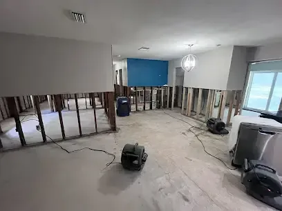
How the extraction and drying work runs
The first job is water extraction. Pumps and extractors take the standing water off the floor, because the longer it sits, the further it wicks into walls and trim.
Next the team opens the wet areas, removes what cannot be saved and sets dehumidifiers and air movers. The team measures moisture and writes down readings as the materials dry, so there is a record of how the job went.
What usually gets removed
Carpet and pad, soaked insulation, low drywall and any soaked furniture padding are usually the first things out when the water is contaminated.
What can be dried in place
Sealed hard surfaces, framing and solid wood trim can often be cleaned, treated and dried in place. Readings, not appearances, decide when drying is finished.
Using the gauge before and after a storm
A gauge is most useful when it is watched before the water arrives.
Roads usually reopen long before wet materials are dry. A building can look fine on the surface while the framing, insulation and subfloor are still holding water.
- Check the Cooper River gauge during and after heavy rain.
- Keep cars off Grove Street and Coles Mill Road when the readings climb past the street levels.
- Never drive or walk through flood water to get a better look.
- Take dated photos of any water that reaches a building, with a clear view of the high water mark.
- Read up on storm flood cleanup before a storm so the next steps are already known.
Questions
What does a reading of 2.5 feet on the Cooper River gauge mean?
The weather service notes say water begins to overflow the banks into Maria Barnaby Greenwald Park. It is the first stage, and it points to parkland, not houses.
At what reading do Grove Street and Coles Mill Road flood?
Both begin to take on water at 5.5 feet. The notes say flooding there increases at 7 feet and that Coles Mill Drive cannot be driven.
Does the gauge say how many Haddonfield homes flood?
No. The gauge notes describe parks, paths and roads. They do not count flooded houses, so they should be treated as a warning signal only.
Is flood water from a creek or street safe to clean up with a mop?
No. It is contaminated, and a mop leaves soaked porous materials in place. Extraction and proper removal come first.
Can heavy rain flood streets even when the river stays low?
Yes. The early July 2023 storm left flooded streets, fallen trees and downed utility wires in the borough.